Summer School I
Salzburg, Austria
July, 2022
Salzburg, Austria
July, 2022
The Multi-sensor Earth Observation in Practice Summer School, which held from the 28th of June to the 5th of July was organised by the Department of Geoinformatics, Paris Lodron University of Salzburg. It was an intensive five-day learning program that provided state-of-the-art practical and methodological skills to characterise complex geographical features using EO data and various remote sensing techniques and ended with a presentation of workdone at the GI-Salzburg Conference 2022
The summer school started with preliminary presentations to acquaint participants with key environmental challenges of today and the various Earth Observation (EO) techniques, data and environmental government policies which are available to tackle these problems. There was also a lecture on biotope mapping using remote sensing techniques and in accordance with the biotope mapping guidelines of the Europeann directives. The lecture assessed previous studies on biotope mapping such as 'The development of a transferable framework to map biotope types in the Alpine region' as well as 'the mapping of the Riparian Forest Types based using guidelines defined by the the European Habitats Directive (Article 17, Annex I)'. The lecture also touched on major challenges of biotope type mapping which include data quality, seasonal/annual changes (temperal and spectral) in landuse and plant phenology, identification of optimum vegetation monitoring season and the challenges encountered when characterising real world objects to build a knowledge database.
There were also lectures on satellite image time series in the big EO data context with a major focus on EO Data Cubes for large scale geoprocessing and time series analysis. The lecture ended with an intensive hands-on session on Surface Change Analysis of RoskFall in Val, Tirol (Austria) using the Austrian EO Semantic Data Cube.
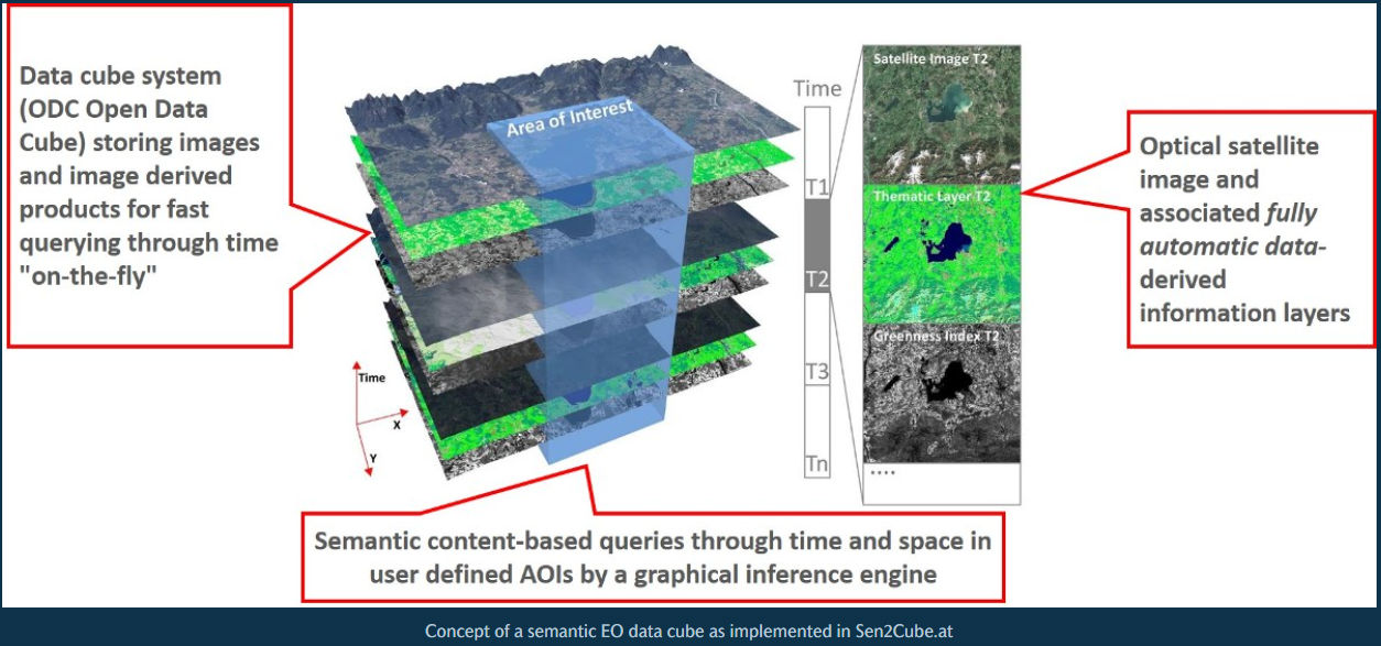
Image Source: sen2cube.at
On the second day of the summer school, there was a lecture on Radar Interferometry (InSAR) which introduced participants firstly to the Synthetic Aperture Radar (SAR) geotechnology and its significance in the EO domain. Thereafter, participants were presented with a robust theoretical background of radar interferometry for Digital Elevation Model (DEM) generation after which an intensive hands-on session on the generation of DEM using radar interferometry steps were implemented in the ESA SNAP software. An attempt was also made at introducing an automation of the interferometry processes using python programming.
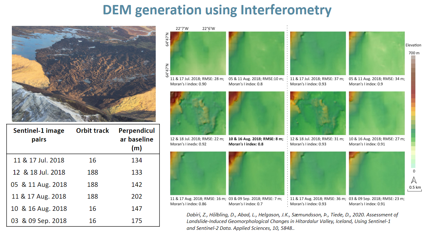
Image Source: Dabiri, Z. et.al 2020
Additionally, there was a very detailed lecture on Landslide mapping and monitoring using remote sensing where participants were introduced to the predominant landslide risk factors and mitigation strategies. An highlight of the lecture was an in-depth discussion on the challenges and differences between the use of OBIA or Manual mapping for disaster change analysis.
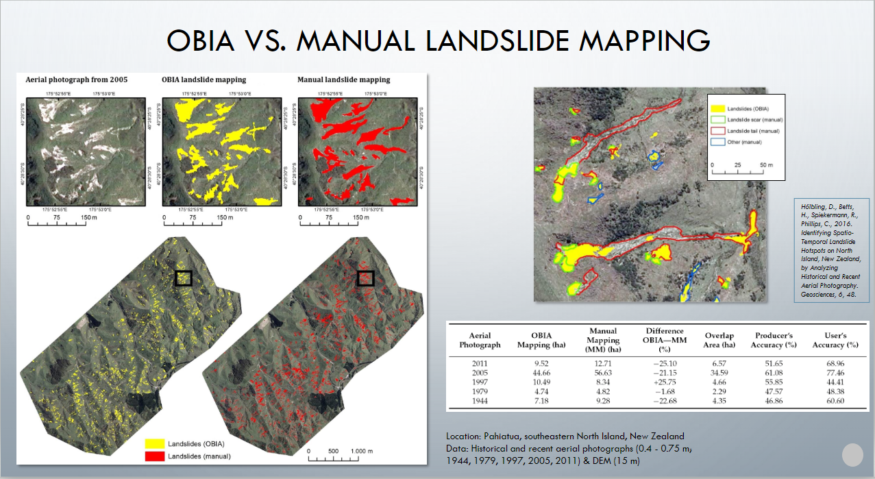
Image Source: Holbling, D. et.al 2016
The third day of the Summer School was an in-depth lecture focused on Cryospheric Mapping using Remote Sensing methods. The lecture presented OBIA and deep learning techniques methods as state of the art solutions to the glacier landform mapping challenges. The importance of cryospheric mapping cannot be overempasised now more than ever before due to extreme effects of climate changes in the polar regions. Multispcetral images helps to distinctly differentiate clean ice areas using its spectral signatures. Debris covered ice on the other hand is not easily distinguishable spectrally. SAR images helps to better identify debris covered ice areas using its backscatter coefficients. Image segmentation using OBIA techniques further helps to add more information to the classification. Employing deep learning algorithms however helps to ensure a betetr classification using trained samples.
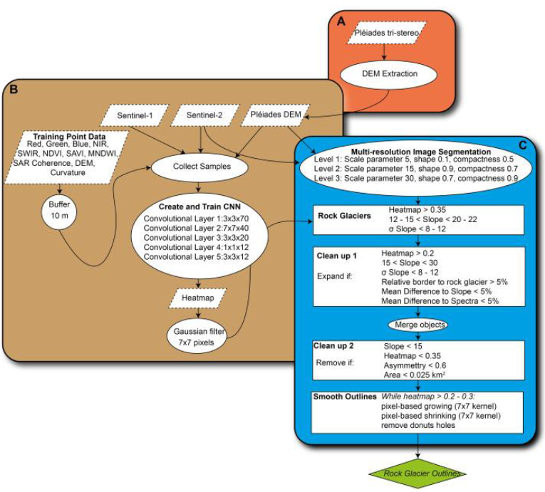
(Image Source: Robsin, et.al 2020) Figure illustrates the Cryosphere Mapping Workflow integrating OBIA and CNN Methods
The fourth day of the summer school was a field trip for the acquisition of UAV data of Werfenweng region, Salzburg. During the field trip, participants took a 1-hour long hike up the mountain which is about 890meters high. There, participants mapped the region using an Unmanned Aerial Vehicle (UAV) also known as a Drone. The flight plan was done automatically using Dronelink application and control points were spread across two different regions before the drone mission started. The field exercise took about two-three hours after which participants had a great lunch together at the mountain house while enjoying the picturesque landscape.
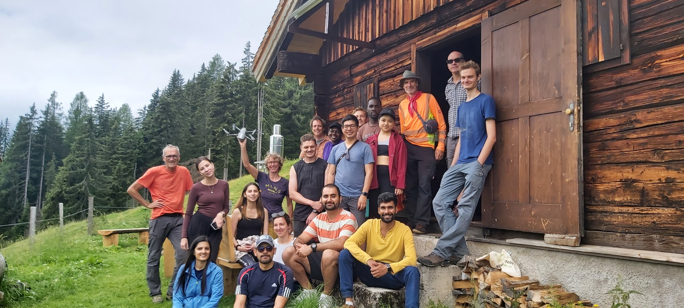
Image Source: Summer School Coordinator
UAV aerial images collected from the UAV field mapping trip served as point cloud data which was used for elevation modelling of the Werfenweng region earlier visited. The data was porcessed using Agisoft Metashape software